
Magma movement underground are causing seismic tremors on an extraordinary scale.
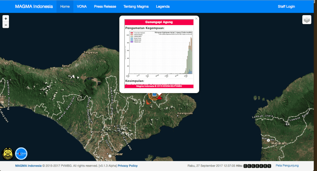
For continuous updates on the seismic activity see the following direct link on Magma Indonesia. The link will show a map indicating earthquakes and active volcanoes. Zoom in on Baly (low center).The image above is a screenshot of 9-27, showing yesterday’s M 4.2 earthquake at the foot of the volcano. Click on the Agung Volcano and scroll down to check the chart of seismic tremens.
The last eruption of Agung in the 1960s cooled the planet by 0.4 °C.
Hundreds of dead birds seen near Bali volcano as nearly 50,000 people flee danger zone
Australian airlines are closely monitoring Bali’s biggest volcano, which is expected to erupt any day.
Hundreds of dead birds have been filmed around Mount Agung as the intensity and frequency of tremors near the volcano increase.
Nearly 50,000 people have fled their homes, seeking shelter in squalid evacuation centres.


Leave a comment